AI Needs to Know Where the Work Is Happening
What if the most important part of AI is the part nobody talks about, not the chatbot, but the map underneath the world?
In this episode of AI-Curious, we talk with John Lenahan, Head of Esri’s Global Commercial Services team, about geospatial AI, GIS, and why “where” may be the missing context in so much of today’s AI conversation.
Original episode title: The Missing Half of AI: Geospatial Intelligence, w/ John Lenahan
Guest
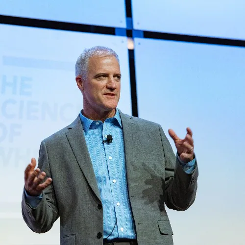
John Lenahan
Geospatial intelligence leader
John Lenahan leads Esri’s Global Commercial Services team. His work applies geographic information systems, spatial data, and geospatial artificial intelligence to business and operational problems, including infrastructure, supply chains, public safety, and urban planning. He focuses on turning location-based context into decisions that organizations can act on.
Shows why AI needs physical context: terrain, infrastructure, weather, proximity, and place can change the meaning of the same abstract signal.
 Watch on YouTube ▶
What this conversation is really about
John Lenahan argues that AI without geospatial context misses the physical conditions that change a decision. Terrain, soil, weather, infrastructure, distance, population, and local risk can make the same abstract recommendation useful in one place and dangerous in another. The episode’s examples span routing, safety, permitting, supply chains, maintenance, and public response. Its durable contribution is not that maps solve judgment, but that place-specific data and contestable assumptions belong inside any system acting on the physical world.
From the conversation
The argument in focus
John Lenahan
Geospatial intelligence leader
John Lenahan leads Esri’s Global Commercial Services team. His work applies geographic information systems, spatial data, and geospatial artificial intelligence to business and operational problems, including infrastructure, supply chains, public safety, and urban planning. He focuses on turning location-based context into decisions that organizations can act on.
Shows why AI needs physical context: terrain, infrastructure, weather, proximity, and place can change the meaning of the same abstract signal.
Evidence status
Vendor-reported case
A geospatial-platform leader describes customer and public-sector uses involving maps, sensors, infrastructure, and agents. The workflow examples are specific; reach, performance, and deployment claims remain attributed.
Boundary map
Where the system stops
- What the system handles
- Joining spatial, sensor, demographic, weather, infrastructure, and operational data for routing, planning, monitoring, and scenario analysis.
- What remains human
- Local knowledge, data quality, public priorities, permitting, safety thresholds, emergency authority, and decisions about affected communities.
- What remains open
- When spatial systems recommend action, can decision-makers inspect the local assumptions and contest the data that made one place appear safer, cheaper, or more expendable?
Ideas worth carrying forward
- Add place, time, infrastructure, and exposure before treating an abstract pattern as actionable.
- Keep spatial-data quality and local assumptions inspectable.
- Give affected communities a way to contest the map and its categories.
- Separate platform reach and product capability claims from observed outcomes.
What this changes Monday
Choose one AI-supported decision with a physical consequence. Add the relevant terrain, weather, infrastructure, access, demographic, and hazard layers. Identify who maintains each source and how quickly it becomes stale. Then ask a local operator or affected person what the map omits before automating a recommendation.
Original episode notes
What if the most important part of AI is the part nobody talks about, not the chatbot, but the map underneath the world?
In this episode of AI-Curious, we talk with John Lenahan, Head of Esri’s Global Commercial Services team, about geospatial AI, GIS, and why “where” may be the missing context in so much of today’s AI conversation.
We explore how maps become far more powerful when they layer in infrastructure, weather, sensor data, supply chains, demographics, and risk, and how AI can help turn that complexity into faster, more actionable decisions.
We also get into what this looks like in practice. We discuss the Baltimore bridge collapse and how responders were able to build an operational model of the wreckage in a day instead of spending weeks or months trying to recreate the scene.
We look at how Raleigh is using spatial AI and computer vision to improve cyclist and pedestrian safety, how cities can rethink bus routes and permitting, and how companies can uncover risks they did not even realize they had, like suppliers concentrated in the same vulnerable region.
This conversation also explores the bigger business case for spatial intelligence. We talk about why a pipeline is not just a line on a spreadsheet, how terrain and soil can change maintenance costs dramatically, and why AI gets much more useful when it understands the physical world instead of treating everything like abstract text.
We also discuss the risks, from trust and transparency to keeping humans in the loop when real lives and real infrastructure are involved.